

Gửi bình luận
DNO - Tropical storm Koto, which entered the East Sea late Tuesday night, has changed its direction to the west-northwest (previously northwest), and is intensifying as it progresses, according to the latest update from the National Center for Hydro-Meteorological Forecasting.
.jpg)
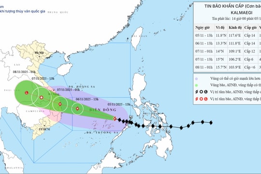
At 1:00 pm on Wednesday, the center of the storm was at about 12.4 degrees North latitude; 116.6 degrees East longitude, about 280km east northeast of Song Tu Tay Island.
The strongest wind near the storm’s center was level 9 (75 - 88 km/h), with gusts up to level 11. Storm Koto is moving west-northwest at a speed of about 20 km/h.
At 1:00 pm on November 27, the storm will be located in the middle of the East Sea, about 150km north of Song Tu Tay Island. It is predicted to move in the west-northwest direction at a speed of about 10 km/h and is likely to strengthen.
Commenting on the storm's future trajectory, Mr. Mai Van Khiem, the Director of the National Center for Hydro-Meteorological Forecasting, said that the storm’s development is still highly uncertain, with significant variations in the forecast models from both domestic and international meteorological agencies.
He said that from November 28 onwards, as the storm approaches longitude 113 (north, central and southern areas of East Sea), the weakening of the subtropical high-pressure system and the formation of a low-pressure trough in the upper-level westerlies at 5,000 meters may alter the typhoon’s course. As a result, three possible scenarios are being considered regarding its path and impact on the surrounding seas and coastal areas of Vietnam.
Specifically, according to scenario 1 (probability 70%), the highest possibility is that the storm will change direction to the north when as it nears the northwest of the Truong Sa special zone (approximately 500km east of the Gia Lai-Khanh Hoa coast).
As the storm reaches longitude 113°, it could change direction to the north, weakening into a low-pressure area before potentially drifting toward the mainland of central regional localities.
As a result, inland areas from Da Nang to Lam Dong are likely to experience widespread heavy rainfall in the first days of December, particularly along coastal areas. Based on current data, the rainfall is expected to be less extreme than the storm system from November 16 - 21.
Scenario 2 (probability 20%): the storm will not change direction and enter the Gia Lai - Khanh Hoa region. Afterward, the storm may move westward toward the mainland, weakening to a level 8 storm or a tropical depression.
In this case, coastal areas from Da Nang to Lam Dong may experience strong winds at level 8 with gusts up to level 10, and sea waves could reach 3 - 5 meters. Heavy rain ranging from 150 - 250 mm is expected from November 29 to December 1.
Scenario 3 (10% probability): the least likely scenario involves the storm dissipating in the East Sea, with no significant impact on Vietnam’s mainland.
