
.jpg "Storm Bualoi triggers heavy downpours, flooding threat in Da Nang")
Gửi bình luận
DNO - Da Nang is expected to experience a widespread and prolonged period of heavy rainfall surpass 900 mm from the afternoon of October 22 to 27 due to the combined effects of the storm Fengshen’s circulation, a strong cold air mass, easterly wind disturbances, and local topography, according to the National Center for Hydro-Meteorological Forecasting (NCHMF).
Also, there will be a high risk of flash floods and landslides in mountainous areas, as well as flooding in low-lying and urban zones.
Local authorities are urged to prepare response measures for possible river flooding in Da Nang, which may reach alarm level 2 to 3, with some rivers potentially exceeding level 3.
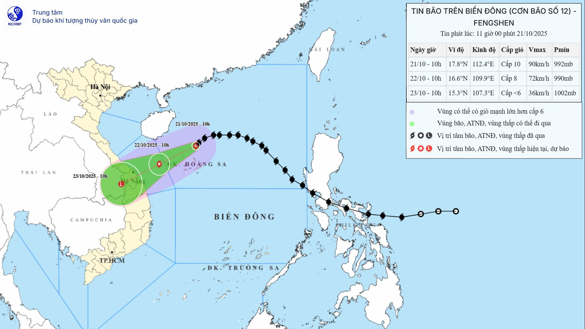
As of 10 am on Tuesday, the storm's center was at about 17.8°N - 112.4°E, about 125km north of the Hoang Sa (Paracel) Archipelago, packing maximum sustained winds of 102 kph, gusting up to 133 kph. It is moving southwest at a speed of 10 - 15 km/h.
By 7 am on Wednesday, it was at about 16.6°N - 109.9°E in the sea west of the Hoang Sa Archipelago, about 190km east-northeast of Da Nang
The storm is forecast to make landfall between Da Nang and Quang Ngai on October 23 morning and then weaken into a tropical depression.
Due to the influence of the storm, coastal waters from southern Quang Tri to Quang Ngai (including the Ly Son special zone) will see winds strengthening from level 6 to level 7 from the morning of October 22, reaching level 8 with gusts up to level 10 near the storm’s center, and rough seas.
All ships operating in dangerous areas at sea are likely to be affected by thunderstorms, whirlwinds, strong winds, and large waves.