

Da Nang faces heavy to torrential rain
DNO - Da Nang is forecast to see heavy to torrential rain through September 13, with authorities warning of flooding, flash floods and landslides as intense rainfall continues across Central Vietnam.
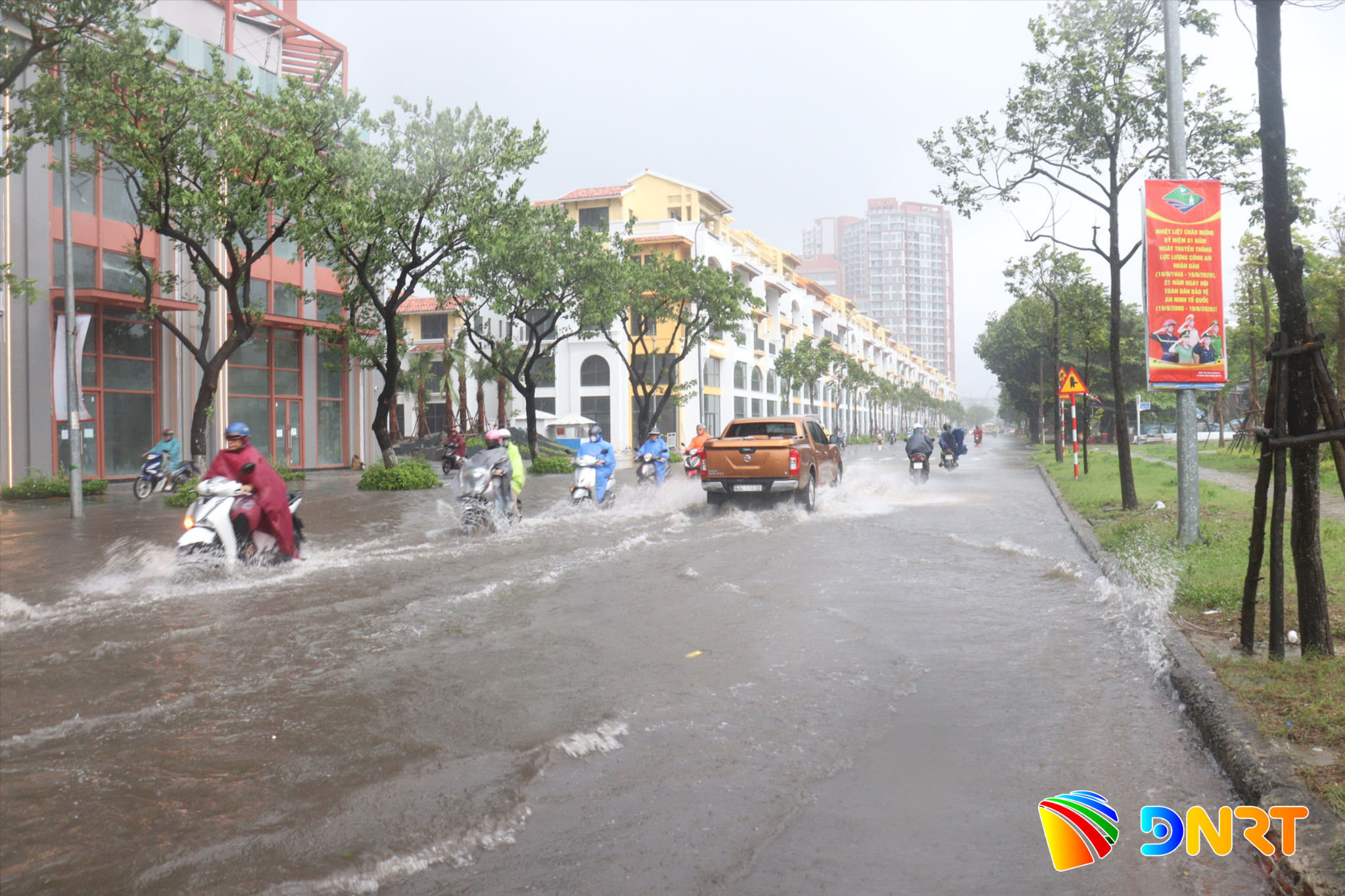
According to the National Centre for Hydro-Meteorological Forecasting, from the morning through the night of September 12, areas stretching from southern Quang Tri Province to Quang Ngai experienced heavy to torrential rain and thunderstorms.
Rainfall generally ranged from 80 to 150mm, and locally exceeding 250mm.
In Da Nang alone, rainfall during the morning and afternoon of September 12 was measured at 20-50mm, with some areas receiving more than 70mm.
The heavy rain could cause flooding in low-lying areas, urban zones and industrial parks.
Authorities also warned of a very high risk of flash floods along small rivers and streams, as well as landslides on steep slopes in several parts of the city.
The situation is expected to continue into September 13. From daytime through the night, areas from southern Nghe An Province to Da Nang are forecast to receive 80-180mm of rain, with isolated areas recording more than 300mm.
Rainfall could be particularly intense, with rates exceeding 100mm within three hours, raising the risk of rapid flooding and dangerous conditions in vulnerable areas.
Authorities have identified a number of communes and wards in Da Nang facing a very high risk of landslides and flash floods, including Ba Na, Chien Dan, Duc Phu, Hoa Vang, Nam Tra My, Hai Van, Lien Chieu, Son Tra, Phu Ninh, Tam My, Tay Ho, Thanh Binh, Tra Giap, Tra Leng, Tra Lien, Tra My and Tra Van.
Authorities are urging residents in flood- and landslide-prone areas to closely monitor weather updates and take precautions as heavy rainfall continues.
Residents can monitor rainfall and water levels through several official digital platforms operated or used for disaster prevention in Da Nang.
The city currently operates 77 automatic rainfall monitoring stations, with data available via the Vrain website and mobile application.
Meanwhile, the Vfass system provides information from eight automatic water-level monitoring stations and 78 flood-warning towers across the city.
Residents can also use the Da Nang Smart City application and the city's flood map platform to check rainfall and flooded areas, report flooding, request emergency assistance and locate safe evacuation shelters.